

Wolfe Ranch cabin in Arches NP
We decided to spend time exploring some of the petroglyphs in the Moab area. While we were in Arches National Park we went to Wolfe Ranch, a homestead site from the late 1800’s. This new improved cabin was built

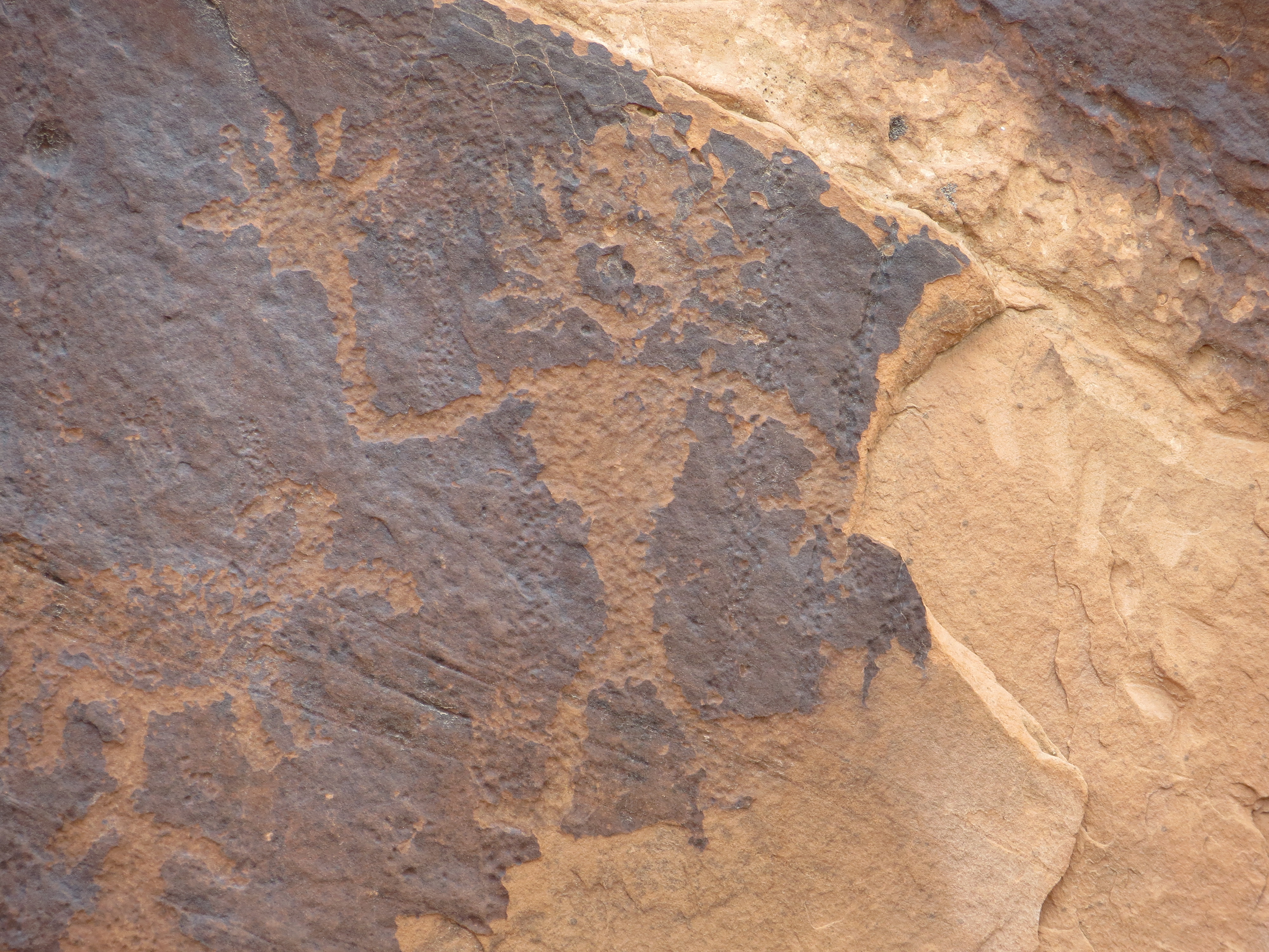
Ute Petroglyphs from the mid 1600’s-1800’s
in the early 1900’s but only used for 4 years, before being abandoned due to the harsh conditions. Near the cabin are petroglyphs dating from the Ute period, the mid 1600’s to 1800’s, that depict cowboys on horseback.
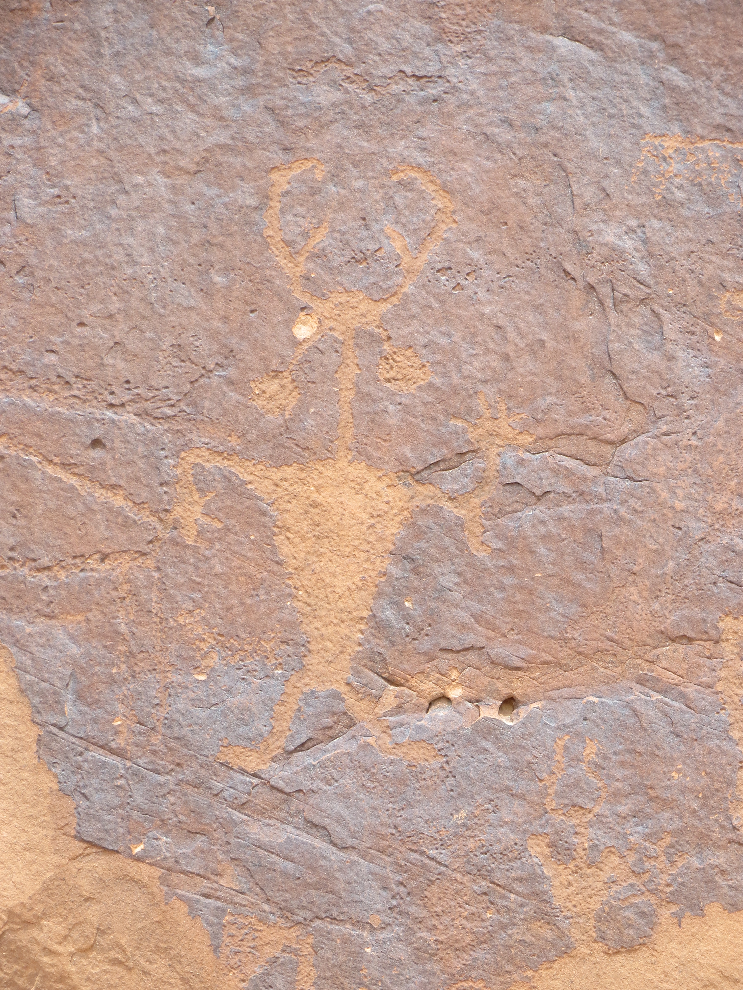
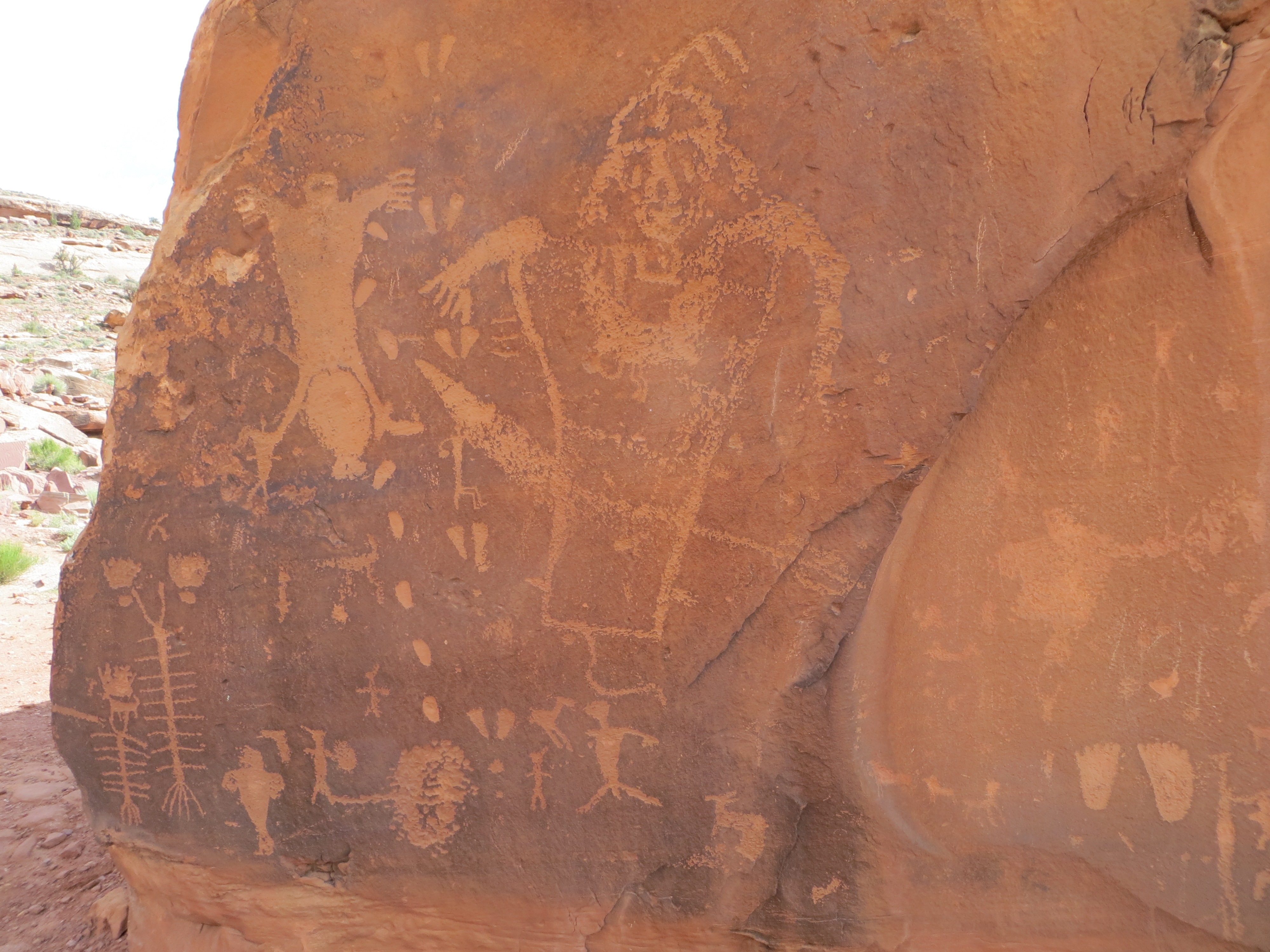
We then traveled the roads on either side of the Colorado River, where some areas of the canyon walls are literally covered with 1000’s of petroglyphs. All of them date from AD 1 to AD 1275 and are from the Anasazi and Fremont styles, 2 distinct cultures that inhabited this region. It was a lot of fun trying to figure out where they were, for they are small and difficult to find and some of them are very high up on the canyon walls.
Headress and ear-bobs
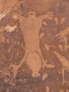
Famous ‘birthing scene’ with feet first presentation of the baby.
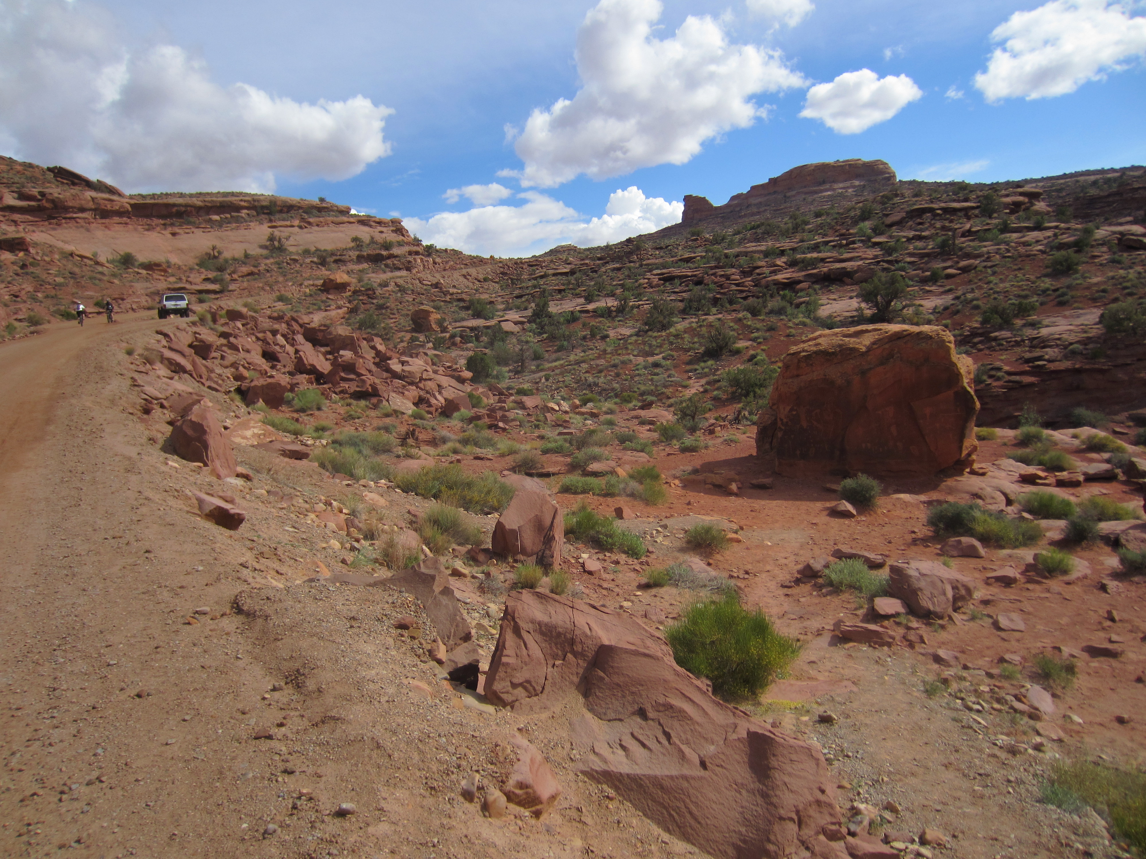
When looking for the last site of the day and seeking a particular parking lot as a reference point, we turned up a dirt road. Our instructions were poor, but we were encouraged by another vehicle following behind us, also looking for the elusive petroglyphs as well as a hidden arch. Up this dirt road we headed, thinking “This is a strange place for a parking lot”, but we were not to be deterred. As Leonard shifted the jeep into 4 wheel drive low and started climbing, the road occasionally narrowed to less than one lane with switchback turns and sheer dropoffs (no guard rails of course). Pam, Rob would have loved this, you… maybe not. We let the pick-up behind us pass and then we were all alone, still looking for our parking lot. Eventually a Jeep came down the hill , we stopped to talk to him and he told us we were on “Pucker Pass” (click here to see a short video). Well, how appropriately named! He informed us that if we continued up it we would go underneath a rock and then eventually come out at Dead Horse Point. Now that was a place I was familiar with from my research, just not this route up to it! So up we continued, Laia bouncing around on my lap (she is such a trooper), a 1000 ft climb in total, and when we arrived at the top it was spectacular. You could see the Colorado River below us and other Jeep trails leading up to the top. We never did find our elusive petroglyphs but this was much better.

The rock tunnel on ‘Pucker Pass’
The large boulder to the right was covered on all sides with petroglyphs

The view from Dead Horse Point
Man or alien?

These shapes are fascinating
‘Moab Man’

Now you are really giving me the itch to travel west! Dead Horse Point is an off-shoot from the White Rim Trail that I want to take the Wide-Ass GSA around at some point before I get too old and scared! You guys are having way too much fun!!! I love it!!!
LOL! In the late 90’s, we rented a Jeep and drove the White Rim Trail. The seed was planted… :). I’m seeing allot of adventure riders out here, Dude. COME ON!! L
I imagine the video cannot give a real impression of the ‘pucker’, but what a spectacular view from the top. I love the cabin image. Where is Kokopelli?
Have’t seen him yet, he must be here somewhere though.
I wonder how those roads are made.
I always wonder the same thing. Logging roads I understand but not these roads.