Monthly Archives: May 2013

Response to a Challenge

THE CHALLENGE:

“Let’s see you take Sweet Jean down the Lion’s Back

THE RESPONSE:

Kitten’s Belly    And yes, it’s steeper than it looks.

Kitten’s Belly Climb   on-board video.

Rocky Climb

Our videos were shot while traveling the trails to Snake House ruins and Butler wash.

Wahweap Hoodoos – Page, AZ

This post is about 5 days late due to our inability to get a strong enough connection to the internet even at busy places like our campground or the marina.  The canyons block all the signals.

While we were at Page we went out to explore some incredible rock formations located only about 20 miles from town and another 10 miles down a 4 wheel drive road.  A friend of ours from Florida, Michael, has joined us here for a few days as he journeys out west.

Wahweap Hoodoos

Wahweap Hoodoos

IMG_1475

Beautiful green, blue and white

IMG_1167

Beautiful sandstone formations

IMG_1450

Some of them where huge

IMG_1177

The brown cap was a layer of composite pebbles that prevent erosion beneath the sandstone

Mister Big Stuff.  Hoo Doo you think you are?

Mister Big Stuff. Hoo Doo you think you are?

We were lucky to be the only ones there

We were lucky to be the only ones there

This one had a tippy cap

This one had a tippy cap

This Horn Toad Lizard was almost invisible against the rocks

This Horn Toad Lizard was almost invisible against the rocks

Of course we had to have a photo of cactus in bloom

Of course we had to have a photo of cactus in bloom

Monument Valley

We’ve been battling poor internet connections for the past week, hence the delay in these posts.

Monument Valley

Monument Valley

After our windy night at Gooseneck State Park we headed to Goulding RV Park in Monument Valley where, guess what, it was still windy.   The monuments were obscured  by clouds of dust.  We learned that there was an approaching front, but that the wind was supposed to die down by the next day.

A Hogan which is a Navajo dwelling

A Navajo dwelling called a Hogan

Fortunately, we were there for 2 days and by the next morning when

Interior of the Hogan

Interior of the Hogan

the wind had settled, we took a 3.5 hr  Navajo led tour of the valley.   This tour took us by a Hogan, which is the traditional Navajo living quarters.   The Hogan is made of logs positioned in a circular pattern, with a central

I love getting my hair done

I love getting my hair done

opening for the fire and a doorway that always faces east.   The exterior is composed of the bark that had been previously removed from the logs.  This bark is laid over the logs and then dirt applied over the entire structure.  This keeps the building cool in the summer and warm in the winter.

A new Navajo maiden has been created

A new Navajo maiden has been created

Inside the Hogan a woman was demonstrating traditional weaving techniques, using wool from the sheep that they raise.  She also wanted to demonstrate a traditional Navajo maiden hair style and since I had the longest hair of all the women there, I was chosen to demonstrate on.    She brushed my hair with a broom-like brush and then started weaving a long piece of wool through it.    It was beautiful and wonderfully cool and stayed tightly in place all day, even when the wind started to pick back up.

Sunset over the rocks

Sunset over the rocks

That evening just before sunset,  we went back out  and drove the 17 mile loop ourselves, where we were lucky enough to see a full moon rising over the monuments.

Gooseneck State Park

Heading south toward Monument Valley, we decided to stop along the way at Gooseneck State Park, which overlooks the San Juan River.    This is a State Park that allows free dry camping on the rim of the canyon overlooking the river.

There are actually 5 turns in the river at this location

There are actually 5 turns in the river at this location

It was beautiful when we arrived and we got a perfect spot close to the rim.  We settled in, put out the awning and chairs and prepared to take a siesta when seemingly out of nowhere this wind came up out of the canyon, straight toward us.   Even though we live in Florida and encounter strong winds during tropical storms, this was much worse.  It was unrelenting, probably at least 40-50 miles an hour, not gusts just steady wind coming out of the canyon and up toward us.   We tried taking in the awning and it became a sail that we had to hang on to with all the strength we had.     The wind whipped our voices away and we could barely hear each other.     We couldn’t get the awning to retract because the metal legs had bent from the wind.    Finally, Leonard was able to remove the legs and we could retract the awning which miraculously had not torn,  but the legs were flopping like broken wings.   Working at them with a hammer, he slowly was able to get them back into position and attached back on the RV.  It was totally exhausting and afterward we just collapsed inside the RV, which was rocking back and forth like a boat.   All that night the wind blew and a thick dust settled on everything.   Sometime early in the morning the wind finally let up and in the morning we emerged from the RV to quiet and beauty with no evidence of what had occurred.   By late morning when we left the wind was gusting once again for other innocent campers to battle.     It seems that all RV’ers  have an awning story to tell and now we have one of our own.

Morning calm

Morning calm

As a side note, the awning was tucked away for almost a week while we have been experiencing high winds, but Leonard and our friend Mike worked on it this morning and lo and behold they rebent the metal, greased it up and it works.  Not great, but enough to give us some shade if we need it.  Glory days.

Gooseneck Stae Park overlooking the San Juan River

Gooseneck State Park overlooking the San Juan River

River House Ruin and Butler Wash Petroglyphs

River House Ruins

River House Ruins

Located close to our campground, but still requiring the use of a  high clearance 4 wheel drive to access it, is River House Ruin.   Once again we had to air down the tires as we set off over soft sand and rough rock.  These roads are very bouncy and now that we know what the Jeep is capable of, they are a lot of fun.  Leonard has a grin from ear to ear after some of the challenging bits.

4 wheel fun

4 wheel fun

It’s strange, we’ve traveled a lot of dirt roads by now and almost never see anyone, but you never know when that will change.  We were on Navajo Reservation land a few days ago, in the middle of nowhere, and came across a truck plowed into the ditch and stuck up to its axle in sand.  It had 3 very intoxicated Indians in it.  Leonard put the Jeep through its paces again by pulling them out with all of them still in it because they were too drunk to get out.  They may never remember how they got out of that ditch.

Metate - corn grinding rocks.  Every ruin that we have toured has had ancient corn cobs still in them.

Metate – corn grinding rocks. Every ruin that we have toured has had ancient corn cobs still in them.

Then today, as we were returning back out to the main highway on this

Metate in window sill overlooking San Juan River

Metate in window sill overlooking San Juan River

very rough road and having not seen one other person all day, we came across a broken down ATV with a couple from Louisiana and their cocker spaniel.   They had ridden that thing about 30 miles on dirt roads from their campsite and were trying to get to the ruin.  It was already fairly late in the afternoon and we were just flabbergasted.   The guy thought his fuel pump had gone out and after consulting we all decided we would take his wife back to their campsite,

Butler Wash Petroglyphs

Butler Wash Petroglyphs

where she could get their truck and come back and pick him up.   Then miraculously the ATV  started, apparently just vapor-locked.  We followed them out as far as we were going, to ensure  they were okay, still just amazed by encountering  them and then watched them and the dog bounce merrily away.  You just never know what you’re going to see in the desert.

Some of these petroglyphs and nearby ones date back 13,000 years

Some of these petroglyphs and nearby ones date back 13,000 years

The River House Ruins had parts that were originally 3 stories but are in poor shape today.   The great fun was the road into the ruins and stopping by an old homesteader site along the way.

A mile further down the river from the ruins is the Butler Wash Petroglyph Panel, which is probably about 100 yards long.  There were 1000’s of them etched into the canyon wall and they were in amazing shape.    These petroglyphs and those from a nearby site called Sand Island, which we visited a few days ago, contain carvings ranging as far back as prehistoric times.  The Sand Island site has a woolly mammoth carving that has been determined to be 13,000 years old.  We tried finding it amongst all the others but never could.

Claret cup cactus

Claret cup cactus

Hovenweep National Monument

Hovenweep National Monument

Hovenweep National Monument

Towers at Square Tower Unit

Towers at Square Tower Unit

We decided to go on a road trip and headed for Hovenweep National Monument, located about an hour east of here on the border of Utah and Colorado.

Hovenweep is comprised of 5 different sections that contain towers grouped at canyon heads that were built by the Anasazi in the mid 1100 – 1250 AD.  The earliest towers were round or square buildings, but as time went on they became more elaborate – multi-storied, oval, rectangular or D-shaped.  Many theories have been offered to explain the existence of the towers including –   Observation; Signaling Stations; Living or Work Rooms; Ceremonial Chambers; Storage or Defense.

Storm clouds moving in

Storm clouds moving in

We hiked a two-mile trail around the main set of towers, the Square Tower Unit, dodging rain drops and then drove on a

Towers and fragrent Clliff rose which were in full bloom through the park

Towers and fragrant Cliff rose which were in full bloom through the park

Amazing Tower built atop a rock in Holly Unit of Hovenweep

Amazing Tower built atop a rock in Holly Unit of Hovenweep

Holly Unit of Hovenweep

Holly Unit of Hovenweep

rough, dirt road to the Holly Unit.  The views were amazing and made even more so by the storm clouds that were surrounding us.

The skies had been blue when we left the campground but darkened the closer we got to Hovenweep.    We were lucky enough to only get a few sprinkles,  never the deluge which threatened, but it was extremely windy and cool.

When we returned to the campground we heard that the same storm system was responsible for all the tornadoes and deaths in Oklahoma.  We’ve been unbelievably lucky with the weather on this trip, seeming to skirt all the big issues.

Along the road leading to Hovenweep

Along the road leading to Hovenweep

Georgous spring storm

Georgous spring storm

16 Room Ruin – Bluff

16 Room Ruin

16 Room Ruin

We’ve moved further south, to the small town of Bluff, where we decided to explore a ruin close to town called 16 Room Ruin.   Unlike the other ruins that we’ve

Taking in the great view

Taking in the great view

toured which have been located in canyons, this ruin was built overlooking a broad, fertile valley and the San Juan River.  We were able up to drive to the bottom of it,  a nice break after hiking all the canyons.

Some of the connecting rooms

Some of the connecting rooms

The ruin was built on a very narrow ledge in a large cave-like alcove.  The ledge is so narrow that there is only room for a single row of rooms between the alcove wall and the drop off.   Due to the narrowness of the ledge there were no outer doors to all the rooms, but only inner connecting doors and  access through the roof.   One whole section was two-story with inner doorways and peepholes that looked out to the valley below.

Overlooking the valley and San Juan River

Overlooking the valley and San Juan River

Columbines carpeted the area in front of the run

Columbines carpeted the area in front of the run

House on Fire Ruin

After our last hike we opted for a more leisurely hike yesterday to a site that is sought after by photographers from around the world.  It is a small group of ruins that are built under the usual sandstone escarpment.   When the sun is at a certain angle in late morning, it reflects light up to the sandstone ceiling and  makes the whole thing come alive, as if it were on fire.

By the time that magic hour approached there were about 6-8 photographers there all with their tripods and one guy with a large format camera using plates to capture images.   We had more fun just watching all the nervousness and repositioning by them than we did worrying about getting that perfect shot.  I know my camera isn’t adequate for that,  but it does one thing that theirs does not…it sits in my pocket.

House on Fire ruin

House on Fire ruin

IMG_0937_1

House on fire without the fire

House on fire without the fire

Brush with the Law

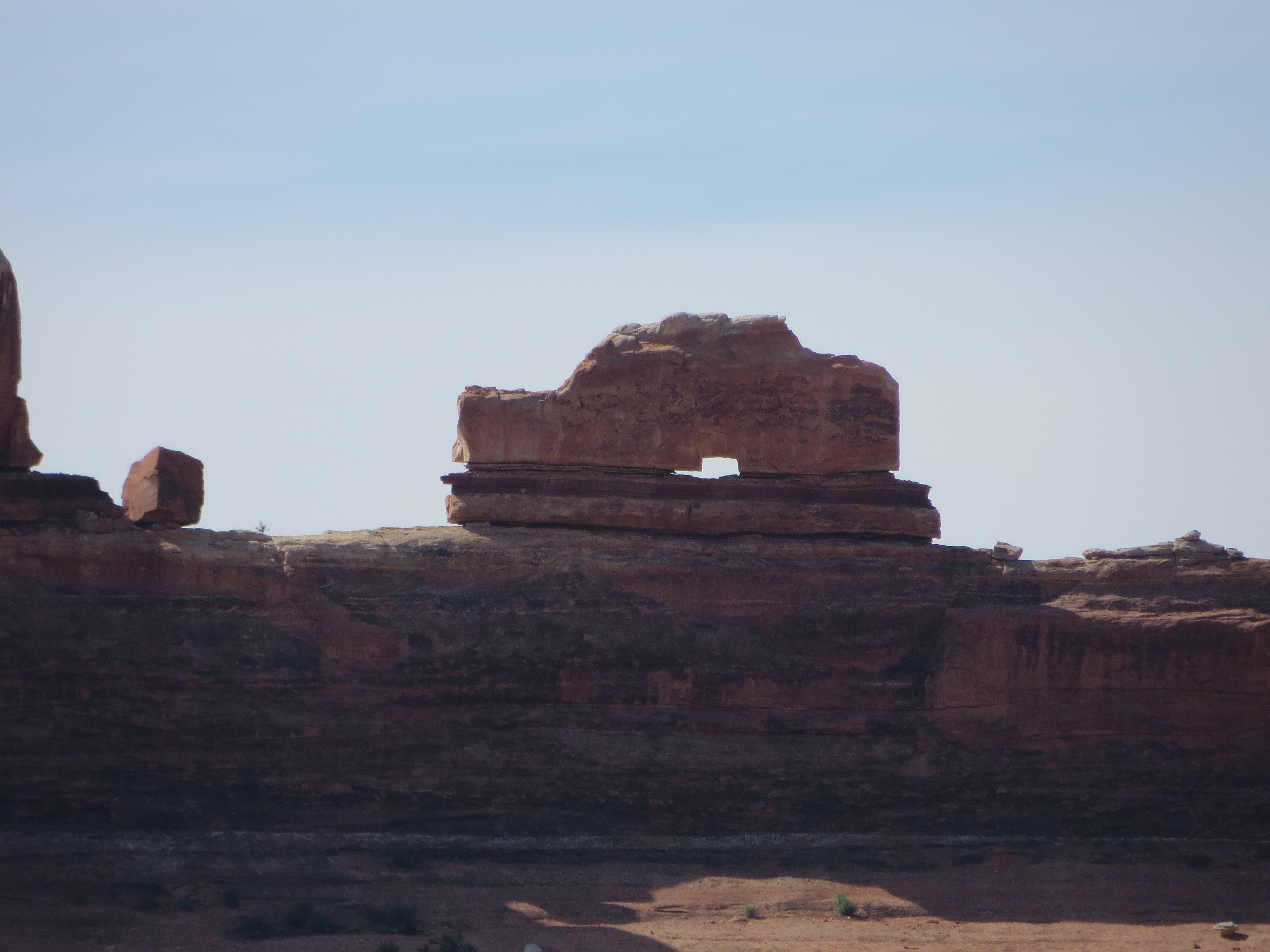
We had just returned to Moab after a full day of adventure in Arches National Park. It was around 5 in the afternoon, overcast skies and about 72 degrees. Being mighty hungry and parched, we decided to stop in at the Moab Brewery. Laia was with us but had to stay in the Jeep as they didn’t allow dogs in this restaurant.  The Jeep windows were open a tad and she had plenty of water available. We were seated at a table facing the parking lot and had a partial view of the Jeep (fortunately, as you’ll see). I ordered a beer and Jean, a margarita. As we waited for our drinks and starting looking at the menu, both of us noticed this short, stocky woman with long frizzy grey hair. She was probably in her mid to late sixties and looked like an old hippy. Our drinks arrived, we took a few sips (gulps for me),  and were still looking at the extensive menu when we noticed hippy lady go out and get into her truck (which was parked in front of our Jeep). Shortly after that, she got back out and walked around the Jeep. We knew something was going on, so I went outside to see what she was up to. As soon as she saw me she said, “Is this your Jeep? You need to get that dog out of there NOW. It’s a good thing you showed up I was about to break your fucking window! I’ve already called the police and am getting ready to call animal control” I calmly said, “I appreciate your concern but I’m sure the dog is fine, we’re from Florida, we know about hot cars and it’s just not hot outside today, she’s fine.”

Her; “If you don’t let that dog out of there right now I’m going to break your fucking window and let her out, can’t you hear her whining?”

Me: “The dog is whining because we’re standing right here.”

About that time I noticed my license plate was bent. I asked her if she did it and she said, “Yes, I was trying to let the dog out and was about to break the fucking window, etc, etc,”

Hoping to calm her down, I opened the door to the Jeep and, of course, Laia was fine. She asked me what I was going to do now and I said I was going to go back and have my dinner. Not what she wanted to hear! As she was now getting into her truck she starting on her tirade again, with plenty of F bombs sprinkled in, telling me to go back to F’n Florida and that she was going to break my windows if I leave the dog in the car. (We had a bit of an audience by then, as you can imagine).

About that time the police arrived, along with animal control. I was glad, by then, my beer was getting warm and this witch was starting to get on my nerves.

In the meantime, Jean is sitting in the resteraunt watching all this unfold. The waitress is telling her that is against the law to leave your dog in the car in Utah. She’s thinking I might be arrested, the dog might be impounded, you know, all the bad things that can run through your mind. Finally, she asked the waitress if she could leave to see what was going on. (She didn’t have any money on her).

The policeman asked for ID and my side of the story. Meanwhile, the animal control officer did the same of Crazy Moab Lady. Shortly after that, the policeman went over to interview her and the animal control officer came to talk with me. Using a laser thermometer, he checked the interior temperature. It was only 80 degrees in there.  He noticed the water and the slightly opened windows. He said everything was fine. I was never worried.

Next, the police officer came over and asked if I’d like to press charges (which surprised me a bit). I said no thanks, I just want to get her out of my hair.

Finally, it was over. She drove away.

We finished our drinks, but didn’t feel like staying. A meal to go was ordered.  The evening ended with a fabulous meal and Laia at our feet, in the comfort of our home on wheels.

As an aside, (thanks to a good friend who did some research on it):

He checked online and could find no statewide law for Utah.
Here are a couple of links:
http://www.animallaw.info/statutes/statestatutes/stusutset.htm
http://www.peta.org/issues/companion-animals/dog-hot-car.aspx
As to Grand County:
http://www.grandcountyutah.net/pdf/code/UT%20Grand%20Co%20T06.pdf
Chapter 6.16, section B, number 7 –

7. No person shall leave an animal inside a hot automobile in hot weather sufficient to cause suffering or death to such animal. (Ord. 129 Art. VIII, 1977)


The Homemade Harbor Freight Camper

  If you ever wanted to build yourself a decent, hard-sided camper trailer, for under $1000, then check this out.

Note the "Slide Out"

Note the “Slide Out”

It is based on this trailer.  He had a number tips about the building process.  Putting bubble levels around the trailer and using the stands are apparently crucial during initial construction and later when setting up  for camping.  This is due to flexing of the trailer.  You can see his solar heated hot water tank (the blue jug wrapped in plastic).  Also note the solar panels behind the trailer.

IMG_1212

The Inside

It has all the amenities, including a shower, sink, and portable toilet.  Looks like it sleeps two comfortably.   When it is folded down, the wind profile is extremely low.  That and its light weight make it very easy/economical to tow.  He pulls it with a Geo Tracker!

McCloyd Canyon and Moonhouse Ruin

Becoming emboldened by our previous successes, we set our sights on a significantly more challenging ruin called Moonhouse Ruin, located in McCloyd Canyon.    Moonhouse Ruin has such special significance that the BLM only allow 36 people a day access to the ruin and you must come to their office and get a permit prior to going out to the site.   Their office was located 45 mins from our campground and we got there at 915 hoping to score two of the permits.  Well,  we were the first people asking for permits for that day and as it turns out we were the only ones out there all day.

It took another hour to drive not quite 10 miles, down a slickrock and very rough road, just to the reach the hiking trailhead.     We set off on the hike, carrying plenty of water, snacks and keeping a wary eye for a rattlesnake that was supposed to live along the trail.

View of Moonhouse Ruin from north side of canyon

View of Moonhouse Ruin from the opposite side of the canyon

Apparently all of the ruins in these canyons are situated on the south-facing wall of the canyon, so that they get the afternoon sun.  They are located under escarpments near the top  and the approach to them involves hiking in from the opposite side of the canyon, dropping down to the canyon floor and then back up to where the ruin is located. This hike was even more work, scrambling on slickrock,  over large boulders and loose rocks and at one point having to drop over a rock ledge with no hand holds.  I used all my Fiery Furnace skills and moved at a snail’s pace at times, but eventually made it.  No wonder these sites are not heavily visited, they’re not roadside attractions.

Outer area of ruin with small granaries overlooking the canyon

Outer area of ruin with small granaries overlooking the canyon

Moonhouse Ruin is unlike any of the other ruins, built with an outer wall, a hallway and inner rooms.  Due to its remote access it is in great condition with original wooden beams, mud plaster on the walls and even the twine that binds

Inner hallway leading to many rooms.  The outer wall has holes in it for viewing canyon below

Inner hallway leading to many rooms. The outer wall has holes in it for viewing canyon below

the beams together.   Some of the wooden beams have been ring-  dated and it has been determined that the structure was built in 1260 AD.   There is also a  room that has a painted panel across the bottom of it with a full moon on one side and crescent moon on the other side.  It is unknown what the significance is, but probably ceremonial.

Room with painted panel showing a full moon on one side and crescent moon on the other side

Room with painted panel showing a full moon on one side and crescent moon on the other side

The outer wall has many small holes for viewing into canyon below

The outer wall has many small holes for viewing into canyon below

A wall inside a room with intact timbers, twine and mud walls

A wall inside a room with intact timbers, twine and mud walls

We probably spent at least an hour there all alone, eating lunch and exploring everything before beginning the dreaded return hike back down, across and up the other side.  It was brutal, but I made it (though not without the assistance of my darling husband, I might add).

Another view of an interior wall

Another view of an interior wall

Leonard behind defensive outer wall with pictographs

Leonard behind defensive outer wall with pictographs

Tower House Ruins

Tower House Ruin

Tower House Ruin

We’re now settled in the small town of Blanding, which is about  100 miles south of Moab and well situated

Roof timbers for the second story were intact

Roof timbers for the second story were intact

for exploring some of the thousands of ruins that dot the canyons in this region.  After getting settled, we decided to further test our ruin finding skills and see if we could find a 2 story ruin located about 10 miles from town, called Tower House Ruin.

This is a great ruin because it is 2 stories and also has an adjacent building with intact roofing timbers, which is amazing considering they are almost 800 years old.

Room with a view

Room with a view

Timbers and roofing material for second story

Timbers and roofing material for second story

Tower House Ruin overlooking canyon

Tower House Ruin overlooking canyon

The ruins are located in the alcove on the left.  We had to hike down, over and up to get to it.

The ruins are located in the alcove on the left. We had to hike down, over and up to get to it.

Newspaper Rock and Manti-La Sal National Forest

Wooden Shoe Arch for all my Danish relatives!

Wooden Shoe Arch for all my Danish relatives!

We decided to go on a sightseeing trip while staying at the Canyonlands Outpost, and our first stop was to the Wooden Shoe Arch.  We just had to get a picture in honour of my family.  Then it was out of the park and up to the Manti-La Sal National Forest for a  completely different change of scenery.

Newspaper Rock

Newspaper Rock

Along the way we passed “Newpaper Rock” an amazing wall of petroglyghs some of which are 2000 years old.   They were carved into the rock  by all the ancient peoples that inhabited this region and it was amazing to stand there and just look at all the different styles.

Petrographs dating over a span of 2000 years

Petrographs dating over a span of 2000 years

(If you click on a photo in this blog you will be able to see a bigger view of it).

More different styles

More different styles

New and old cultures represented

New and old cultures represented

We then made our way to the Manti-La Sal National Forest just south of Canyonlands with the intention of driving the Abajo Scenic Byway from Monticello to Blanding, at elevations up to 9,000 ft.  It was supposed to be a 30 mile journey but about 2 miles into it we were stopped by snow on the road.  Laia had never seen snow before, so we decided to get out and see what her reaction would be.  It was hilarious, she slipped and slided and then headed for the deepest area,  up to her belly in dirty snow and Leonard in his Teva’s.  That cooled us off.  What to do next, but head back into town for wraps and smoothies.

Stopped by the snow

Stopped by the snow

Leonard and Laia playing in the snow!

Leonard and Laia playing in the snow!

Canyonlands, Davis Canyon and Five Faces Pictograph

Canyonlands Outpost

Canyonlands Outpost

We’ve just arrived back in civilization after spending the last 3 days up in the backcountry of the Needles section of Canyonlands National Park.  We left Moab early in the morning with intentions of getting into Squaw Flats campground, which is the first come, first served campground run by the NPS.   Although we arrived by 930am, alas it was not early enough, people were circling the campground in desperation looking for vacating campers.  Apparently in the high season,  if you’re not there by 7 am staking your claim, you’re out of luck. Fortunately there is a private campground called Canyonlands Outpost that is just outside NP boundary and  is still in the very remote backcountry and we were able to get a spot there.     Staying in the backcountry and off the grid seems to be a particular favorite of Europeans as we were often the only Americans at the Outpost.   There are lots and lots of Germans, Scandinavians, Dutch, etc. renting small Class C motorhomes,  campervans or just rental cars and tents.  They love the Southwest and arrive armed with maps, a lot of research and the desire to see as much as possible.

Glorious sunsets

Glorious sunsets

The temps soared into the 90’s while we were there, but it is amazing how much more tolerable it is without the humidity.  We didn’t use the air conditioner, took naps in our chairs in the shade of the awning and enjoyed beautiful sunsets.  It would cool off into the 50’s at night, such a huge temperature range.

Cave Spring Cowboy Camp

Cave Spring Cowboy Camp

We took several small hikes in Canyonlands NP,  finding some small Anasazi ruins, nice pictographs and the Cave Spring Cowboy Camp.   This was a camp that was used by cowboys from the late 1800’s to the 1960’s before the land became a National Park.

Handprint pictographs in Needles section of Canyonland National Park

Handprint pictographs in Needles section of Canyonland National Park

It was situated underneath a long rock alcove and still contained all their daily living implements as well as a corral for their horses and cows.

This region of Southeast Utah is rich with the remnants of earlier civilizations, primarily the Anasazi, Fremont and later the Ute people.   With a lot of prior research one can travel into the back canyons and discover ruins, petroglyphs and pictographs that few people have seen.  When we decided to make this trip out to Utah, I began to research this region,  intrigued by the photos but the lack of information on how to get to these places.    People are very secretive about their exact location due to fear that they will be overrun with tourists and ruined.    There is even talk that this region of Utah known as Grand Mesa and currently BLM land will one day become a National Park and be given the protection that it needs.   Currently however, it is possible with a lot of hard work, prior research and local insider info if available, to find the ruins in their natural state.  That is what we’re setting out to do.  I think I was an archeologist in my prior life.

Five Faces Pictograph in Davis Canyon

Five Faces Pictograph in Davis Canyon

I don’t remember how I stumbled upon 5 Faces Pictograph but when I realized it would be near where we were staying I knew I wanted to find it.  I could find very little data on it, no GPS coordinates but knew it was in Davis Canyon.  Armed with a great book I have and information given to us from a knowledgeable local, we set off in the Jeep.   Wow, the road was rough… it made ‘Pucker Pass’ look like a beginners road.   We made a wrong turn and ended up at a dead-end, went down another wrong road and then decided to start over at the beginning and try to figure out where we went wrong.  We were in 4 wheel low, had to let air out of the tires and we went an extra 10 miles out of our way (at 5 miles an hour), but we found it!!  There was the hiking trailhead to Davis Canyon.  Now we had to find the actual pictographs.   We wandered the appropriate side of the canyon, found footprints in the sand and felt like Indian trackers.  Eventually we found a small trail and then the pictographs, which are of a style that is only found in the Canyonlands area of Utah.   They are from the Anasazi people and are 700 -1000 years old but seem like they were done yesterday because no direct sunlight hits them.    We were both thrilled to see them and with our sense of accomplishment in finding them.    More ruin seeking will follow.

Laia sporting her new hiking shoes and seeking shade whenever she can

Laia sporting her new hiking shoes and seeking shade whenever she can

We saw this beautiful blue collared lizard along the way

We saw this beautiful blue collared lizard along the way

Negro Bill Canyon & Morning Glory Natural Bridge

Morning Glory Natural Bridge

Morning Glory Natural Bridge

The cactus were just starting to come into bloom

The cactus were just starting to come into bloom

Well my legs have recovered enough that we decided to go for yet another hike, this time into a canyon and along a perennial stream to the back of a canyon.   The trail crossed the stream six times, which was great for Laia allowing her little feet to cool off and there were rocks strategically placed for human feet.   It was about 2 miles to the back of the canyon where it dead ends at Morning Glory Natural Bridge, which is the 6th largest natural bridge in the United States.

Looking toward the entrance of the canyon

Looking toward the entrance of the canyon

It was lovely and cool back there,  with water seeping out of a crack in the rock to form a pool of water for the various dogs to drink.  While we where there having a snack, a large heavy backpack thrown from above suddenly landed very near a woman who was also enjoying her snack.   Then a rope fell over the side of the bridge above us and rappellers started coming down.    Damn, there are people dropping out of the sky everywhere around here.

We need our flower identifier to help us

We need our flower identifier to help us

Along the trail

Along the trail