Monthly Archives: July 2018

Whitehorse, Yukon Territories

IMG_7439

The 2 story Log Skyscraper in Whitehorse.

When a massive influx of military personnel and laborers arrived to work on three major construction projects – the Alaska Highway, the North West Staging Route airports, and the Canol Pipeline – during the post-war boom, housing was at a premium in the once sleepy town of Whitehorse.  A local builder responded to the need in 1947 by constructing the Log Skyscrapers, the first privately built multiple-dwelling rental accommodation in Whitehorse. The Log Skyscrapers are in their original location, and continue to provide residences in an increasingly commercial neighborhood.

These two buildings are the only buildings of this type in Canada and their architectural significance lies in their unusual appearance. The multi-storied log construction has given them landmark status within the Yukon Territory.

IMG_7442

This 3 story Log Skyscraper is adjacent to the 2 story one and both continue to be used today.

You can’t drive into downtown Whitehorse without seeing the famous SS Klondike, a National Historic site and run by Parks Canada.  They offer informative tours on these impressive boats that were so vital during the Gold Rush and up until the 1950’s.

IMG_7461

The only remaining sternwheeler, the SS Klondike in Whitehorse.  The sternwheelers supplied the mighty Yukon river from the early 1900’s to 1950.

Launched in May 1937 after the first SS Klondike ran aground, the sternwheel steamboat S.S. Klondike II plied the route between Whitehorse and Dawson on the Yukon River. She transported general merchandise, local products such as silver-lead ore and gold ingots, as well as passengers to and from Whitehorse and Dawson City until the opening of an all weather road between Whitehorse and Mayo in 1950.   Built specifically to have a very shallow draft for navigating the treacherous Yukon River, she could carry 300 tons of cargo with only a 40 inch draft.   Travelling downstream took approximately 1.5 days, but upstream trips took 4-5 days.

IMG_7462

The SS Klondike was built with an exceedingly shallow draft of only 40″ when fully loaded with 300 tons of cargo.  In addition to all the cargo she also had 40 crew and 75 passengers.

We spent a whole afternoon at the MacBride Museum in Whitehorse.  It’s a very well done museum covering a variety of subjects including the history of the Gold Rush in the Yukon with a great film;  the First Nations culture; animals indigenous to the region; Robert Service and of course a great display regarding the building of the Alaska Hwy during WWII.   BTW, there was a great food truck right across the street for fueling up prior to a busy afternoon.

IMG_7466

A representation of all the gold that was discovered in the Yukon fueling the Klondike Gold rush.

IMG_7471

The Mounties got their girl!

IMG_7451

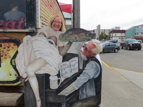
The popular Klondike Rib and Salmon Restaurant is housed in one of the two oldest buildings still in use in Whitehorse.   The dining room was originally opened as a tent frame bakery around 1900.

In 1929 the building was purchased and turned into “Klondike Airways”  and it became a mail and freight business. Although the owners hoped some day to buy a plane as a means of transporting freight and mail, they never did. Using snowmobiles and caterpillars, the company carried about 110,000 lbs of mail to Dawson City each year. Before 1921 only first class mail was delivered in the winter. The rest of the mail waited in Whitehorse for the ice to break up and the steamers to sail which usually happened sometime in May.

P1180026

The canvas interior of the tent/restaurant with artifacts from the region.

P1180027

The best use I’ve seen for a snowshoe!

P1180023

Our last meal together as we were not going any further with our wonderful convoy partners.  They were headed on to Fairbanks and we would wander where ever our hearts took us.

IMG_7449

BC to Watson Lake, Yukon

IMG_7416

Contact Creek, Yukon where northern and southern crews working on the Alaska Hwy in 1942 joined, opening up the southern section of the Alaska Hwy at MM590

When we decided to join Leonard’s two cousins on this trip, we weren’t sure how far we were going to go.  We knew we wanted to go up to Ft St John but after that we were just playing it by ear.  We had been to Alaska twice before on fabulous trips and felt that we really didn’t need to repeat that.  The driving became pretty effortless and the miles slipped away and so we made the decision that we would go as far as Watson Lake just over the Yukon border so that we could say that we had been to the Yukon.    Well, when Leonard was getting a haircut in Dawson Creek, he told his barber that and she said “Why are you going to Watson Lake, there’s nothing there.  You might as well go on to Whitehorse, it’s just a little further and a much more interesting town.”  So that became our plan.

IMG_7438

This is what the gas stations look like in northern Canada, where permafrost makes underground gas tanks unusable. These fuel pumps for gas and diesel are unmanned, use credit cards only and are located in convenient locations along the way.

P1170684

We could go for hours without seeing another vehicle and then it would usually be an RV.

IMG_7426

Nisutlin Bay bridge on Lake Teslin, the longest bridge on the Alaska Hwy.   MM804

IMG_7428

Yukon Motel and RV Park in Teslin on Teslin Lake.    They have a typical campground, a pretty good restaurant and a well done wildlife gallery featuring all the northern animals.

IMG_7424

The truckers up north have serious protection on the front of their trucks. Leonard wants to weld something for the front of our RV.  We’d be indestructible then.  

P1170923

The famous Sign Post Forest in Watson Lake, Yukon

The tradition began during the Alaska Highway Project in 1942, when a U.S. soldier spent time in Watson Lake recovering from an injury. A commanding officer asked him to repair and erect the directional signposts, and while completing the job, he added a sign that indicated the direction and mileage to his hometown of Danville, Illinois. Others followed suit, and the trend caught on. In 1990, a couple from Ohio added the 10,000th sign and today there are over 77,000 signs in the Sign Post Forest.  The number continues to grow.

IMG_7420

There was no way to photograph how big this place was. Layer upon layer, it extended back into the woods for a long ways.

The Alaska Hwy – Ft St John to the Yukon

IMG_7305

Clean windows and a cup of coffee became the morning routine before hitting the road. This was a fairly typical campground in the more remote sections of the Hwy.  Nothing fancy but certainly adequate.

We easily settled into a kind of routine for our journey north.  Leonard & I were delegated lead vehicle due to the fact that we had already sustained front end damage from hitting a deer while in Arkansas!  We knew there would be a risk of hitting an animal on this trip, but never dreamt that it would happen shortly after we left home.  Anyways, due to the fact that our grill was now held together with a strap and we already had a huge chip in our windshield (also from Arkansas – go figure) we got to be lead vehicle and chief animal spotters.  We would see the animals, and relay the info via CB back to the others and they would be prepared with their cameras.  It was fun.  It was nice being in a convoy as there were several instances when mechanical issues arose and between all three of them the proper tool was always found and things got fixed.


P1170698

Tetsa Lodge and Campground – home of the best cinnamon buns on the Alaska Hwy at MM 375.

P1050334

These two young females attracted some male attention from the other side of the lake.           Toad River Lodge and RV Park  MM 422

Toad River Lodge was a nice surprise.  A pretty campground on very pretty lake with lots of wildlife around.  This area is known for it’s wildlife and for being a particularly scenic portion of the Alaska Hwy.  We all agreed that had we known how nice it was there with campsites available right on the lake, we would have stayed another night.  But we had reservations down the road and had to keep moving.  Perhaps next time.

P1050340

Hanging with the horses but gotta go see the girls on the other side of the lake.

P1170763

Trumpeter swans on Reflection Lake at Toad River Lodge and RV Park

IMG_7316

The road less traveled in northern BC.

IMG_7321

There are lots of rivers to cross and this is the type of bridge used.    Some are single wide but most are two lane and they have metal grates for the snow to fall through.

IMG_7338

Woodland caribou hanging out at the rest area.

Having spent the first 13 years of my life in northern BC I was familiar with most of the wildlife but I had never seen caribou.   I thought they were an Arctic animal.  These are Woodland Caribou, a subspecies that is larger and darker than the Arctic caribou and reside in the boreal forest of BC, Yukon and Newfoundland.

IMG_7331

This mother seemed quite content to stay near the rest area. Perhaps she felt more protected there from bears.

IMG_7411

The Wood Bison, a subspecies of the Plains Bison also roam the boreal forest of northern BC.

Another animal from the far northern reaches of BC and the Yukon is the Wood Bison.  We saw quite a few of them, in herds or sometimes just single males.

IMG_7342

This guy was just sauntering down a bridge towards us.  It appears they may not be the brightest animal in the world as we eventually saw quite a few that had been hit by cars.  

IMG_7344

As we slowed down to take photos, he became defensive, curled in a ball and made his quills stick out! Unfortunately when we crossed that same bridge several weeks later we saw a dead porcupine, probably the same guy.

IMG_7350

The boardwalk through the boreal forest to a hidden paradise!   Often there are moose along the pathway, but fortunately we didn’t see any.

IMG_7353

Liard Hot Springs Provincial Park at MM 496

This place is truly a gem and should not be missed if traveling on the Alaska Hwy.  There is a full service campground next to the hot springs that is extremely popular and is usually full by noon.  The springs themselves are open 24 hours, but walking on that boardwalk at night seems risky.  Moose and bear are very common in the area because of the lush vegetation.

IMG_7405

The water was between 108F and 126F. You get in at the coolest area and then when you get used to it you get into the really hot areas (for just a little while).

IMG_7389

The water had a silty appearance from the minerals but no odor and the bottom was sandy. All completely natural.

IMG_7396

It’s extremely lush, almost tropical around the pools. There are even 14 species of orchids that grow there.

The Alaska Hwy-Dawson Creek to Ft St John, BC

IMG_7287

We arrived in Dawson Creek – Mile 0 of the Alaska Hwy and my old stomping grounds.  This fertile grain growing area is called the Peace River Valley and is where I spent my childhood on a 1000 acres we farmed on mile 73 of the Alaska Hwy.    We left here in 1970 and I have never been back.  I always wanted to see what the area looked like now and what became of our land and that became the impetus for this trip.

IMG_7292

Mile Marker 0 in downtown Dawson Creek.

IMG_7296

A final steak dinner before hitting the road and doing some long distances.

The other 2 parts of our convoy headed north from Dawson Creek without us as we took a slight detour visit the W A C Bennett Dam, a massive hydroelectric project built in the 1960’s and considered the largest earthern filled dam in the world.  My father worked on this project and I have lots of pictures of the huge pieces of equipment they used.  (Me standing inside a tire and such).

IMG_7299

W A C Bennett Dam on the Peace River in Hudson’s Hope, BC is the largest earthen dam in the world.

IMG_7298

The dam is 183 meters tall x 800 meters wide by 2 km long.

This photo below cleared up a memory that I had that I didn’t understand.   This is a conveyor belt that they built to move 55 million cubic yards of nearby glacial moraine into the area to build the dam.   It was great to see the photo, I had always wondered about that memory.

IMG_7297

From our detour to the dam we got back on the Alaska Hwy, through Ft St John where I went to school and up towards the old homestead.  The land had all been virgin timber when my father aquired it but we had cleared much of it and were growing grain.  Now it looks like it is all reverting back to bush.  No sign of our house.  At least now I know what became of it.

IMG_7303

Nothing left of our old homestead on the Alaska Hwy.

Jasper Nat Park, Alberta, Canada

P1170157

In perfect weather our little convoy of 3 starts the long journey north.

The 144 mile drive north from Banff to Jasper along the Icefields Parkway should be on everybody’s bucket list.  Every turn brought new spectacular vistas of snow covered mountains, glaciers and numerous animal sightings.  Traffic can be slow because of either construction or congestion due to all the animals along the way.  We saw black bear, mountain goats, big horn sheep, and elk along the way.

IMG_6129

The 144 mile Icefield Parkway is the only route between Banff and Jasper.

P1170232

The glass bottomed Glacier Skywalk, which juts out 1000ft over the valley below.

IMG_7261

The beautiful glacial blue waters at the Saskatchewan River Crossing on the Icefields Parkway.

IMG_6228

The mountain goats were right where they were supposed to be at the Goats and Glaciers sign.

IMG_6213

It must feel good to finally get rid of that ratty old coat!

P1170168

A large group of Bighorn Sheep that slowed up traffic.

Finally we came to the beautiful Athabasca Glacier, one of 6 principle ‘toes’ of the Columbia Icefield.  This is the most visited glacier on the north American continent due to it’s easy accessibility but it may not be here long.  It has lost 1.5 km and over half it’s volume in the last 125 years.

IMG_7275

The Athabasca Glacier in the Columbia Icefields, taken from the Visitor Center across the road. The glacier extended all the way to the Visitor center 125 years ago.

From our campground in Jasper NP we came back down to the glacier so that we could explore it at our leisure.  We arrived early so we could get into the parking lot at the bottom of the glacier and do the 1.4km hike up to the actual ice.

IMG_6132

All around us people were carrying crampons, walking sticks and wearing heavy winter clothes.  We looked like we were out for a summer stroll.

IMG_3449

Now we realized why they were dressed the way they were.  The higher we climbed the fiercer the winds and the colder it got!

IMG_6137

Finally we got up to the glacier itself. Even Laia was freezing and had to be held to keep warm! The people with crampons were on tours and went out walking on the ice.

IMG_6140

The glacier is massive with most of it not visible from this angle. The tiny little dots on the left are snow coaches going out onto the ice.

It was a thrilling to walk all the way up to the ice but alarming to see all the signs along the way marking where the ice had been just a few years ago.

IMG_6141

Looking back down at the parking lot where the Glacier was in 1970 and in the far distance the visitor center which was under ice 125 years ago.  Notice the erosion marks ground into the rocks.


Banff Nat Park, Alberta, Canada

IMG_5995

Lake Louise with fresh snow on the mountains.

So it has been almost 9 months since we completed our trip but because of internet connections in Canada I wasn’t able to complete my blog.  I’m now trying to get caught up and hopefully I will be able to remember everything!

We planned on doing our border crossing at Roosville, BC on Canada Day, July 1 in the middle of the Canadian three day long week-end  and wondered how heavy the traffic would be at the border.  The further north we traveled, the narrower the roads got and the traffic disappeared until we arrived at the border and we were the only ones in line.  What a glorious sight.    Five minutes and a few cursory questions later and our little convoy of 3 motorhomes was across.    A nice painless experience.    Then the scenic drive north through the beautiful Kooteney Rockies in British Columbia towards Banff, Alberta, where we had our first grizzly bear sighting.     We were all staying at Tunnel Mountain Trailer Court which is the Banff National Park Service full hook-up campground.  It was our base for 4 nights and we did our exploring from there. Continue reading

Glacier National Park, MT

IMG_5945

No hiking today at Logan Pass, the highest point on the Going to the Sun Road.

We left Steve and Diana at Lewis and Clark and traveled together with David and Dottie to West Glacier where we met up with the third leg of our little convoy, David’s brother Bill and his wife Connie.  We will now all travel together,  with David and Bill going all the way up and around Alaska and us not sure how far we’ll go.  We’ve been to Alaska 3 times before so we don’t want to drive all that way, but we will go to northern BC and probably the Yukon, so that I can see the homestead where I was raised as a young girl and haven’t seen since I was 15.

Continue reading